NLDAS: Vegetation Class Datasets and Illustrations
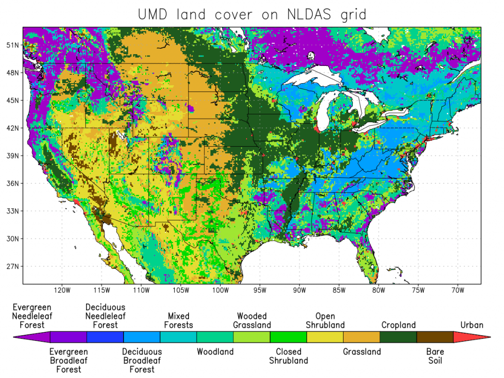
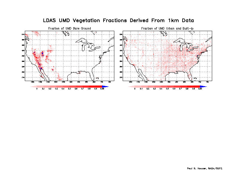
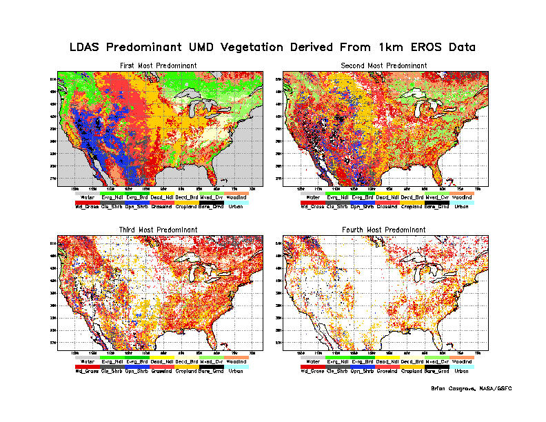
The land mask and land cover classification map used for NLDAS is the University of Maryland's UMD Land Cover Classification. Imagery from AVHRR satellites from between 1981 and 1994 were used to create a static land cover map. The 14-class UMD map at 1-km was used for NLDAS. If more than 50% of all UMD 1-km pixels within each 1/8th-degree NLDAS grid box are identified as water, then the NLDAS land mask is defined as water for that grid box, and no NLDAS output is available for that 1/8th-degree grid box. Fractional coverage amounts were arrived at by first counting up the number of occurrences of a particular type of vegetation (1-km scale) within an 1/8th-degree grid box, and then dividing this number by the total number of 1-km pixels in an 1/8th-degree box.
There are 13 vegetation classes in the dataset, plus one class for water:
    INDEX       CLASS
    -----       -----
      0         Water
      1         Evergreen Needleleaf Forest
      2         Evergreen Broadleaf Forest
      3         Deciduous Needleleaf Forest
      4         Deciduous Broadleaf Forest
      5         Mixed Cover
      6         Woodland
      7         Wooded Grassland
      8         Closed Shrubland
      9         Open Shrubland
     10         Grassland
     11         Cropland
     12         Bare Ground
     13         Urban and Built-Up
NLDAS Vegetation Classes Datasets
- NLDAS predominant vegetation class data (netCDF-4 format)
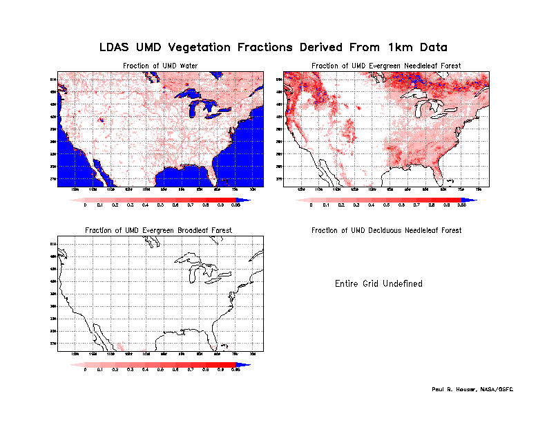
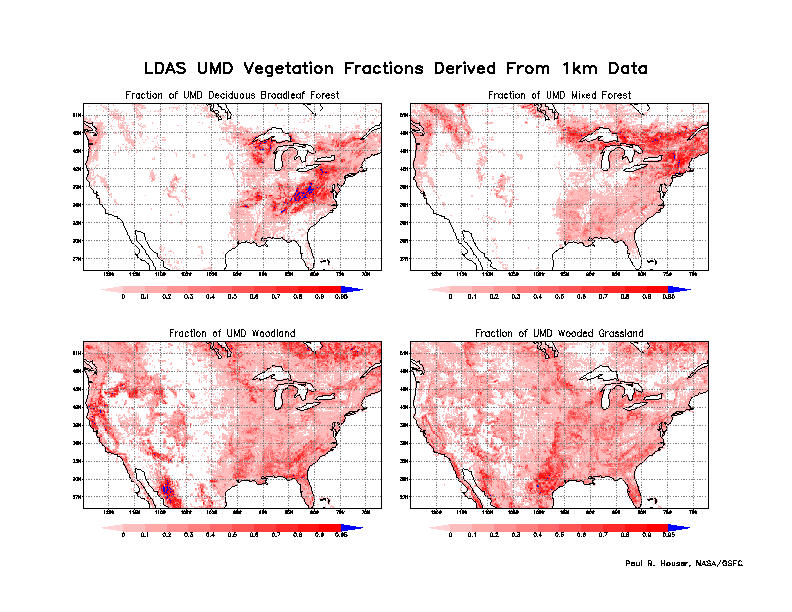
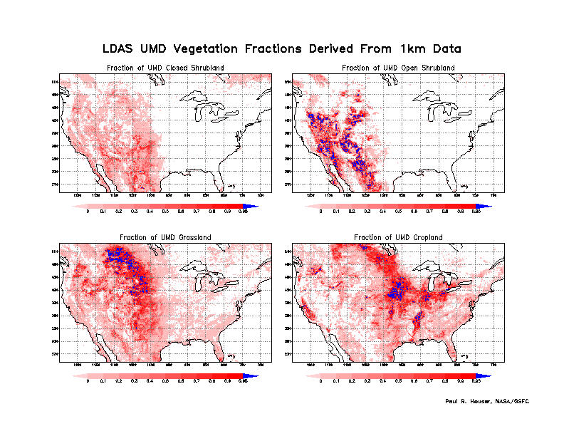
- NLDAS fractional vegetation classes data (netCDF-4 format)
NLDAS Vegetation Classes Illustrations