

GLDAS Soil Land Surface
Land Surface Models use a variety of methods to specify soil parameters. Some LSMs use a soil texture classification scheme to specify soil parameters based on texture classes, while others derive soil hydrologic and thermal properties from sand, clay, and silt fractions. A texture class can be mapped from the fractions of sand, silt, and clay in a given grid cell for the model's soil texture classification scheme. A look up table then provides the model specific soil parameters indexed based on a class.
In GLDAS2 products, our approach is to stay with model’s default parameter datasets as much as possible, as opposed to conforming models to use the GLDAS standard parameter datasets as done in GLDAS1. The soil texture map was used if provided by the model developer, otherwise, it was computed based on the soil fractions. GLDAS uses the top layer soil parameter data for all layers, shown below with the images and links for the data files.
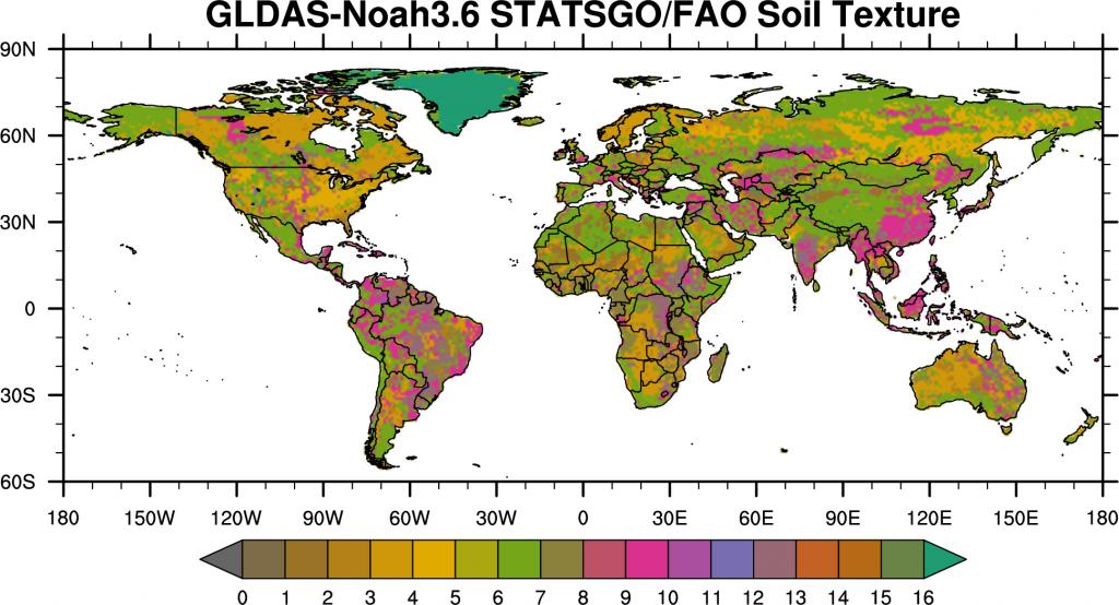
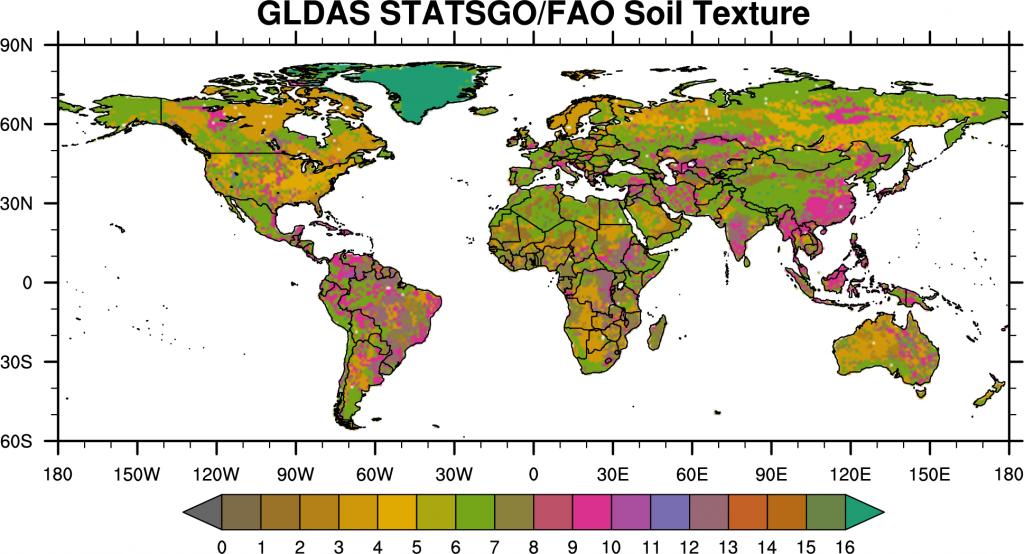
GLDAS Soil Texture
The version of Noah model in GLDAS2 uses the FAO 16-category soil texture class. The map is a hybrid of 30-second STATSGO over CONUS and 5-minute FAO elsewhere, which is available from the NCAR RAL website. Currently, the top layer texture information is used in all soil layers. Soil parameter table is available from the RAL model description site here.
- Sand
- Loamy Sand
- Sandy Loam
- Silt Loam
- Silt
- Loam
- Sandy Cay Loam
- Silty Clay Loam
- Clay Loam
- Sandy Clay
- Silty Clay
- Clay
- Organic Materials
- Water
- Bedrock
- Other
Soil texture used in GLDAS2/Noah
- GLDAS2/Noah Soil Texture Data (NetCDF): 0.25 degree, 1 degree
GLDAS Fractions of Clay, Sand, & Silt
The basic soils information used in GLDAS was derived from the global soils dataset of Reynolds, Jackson, and Rawls [WRR2000]. That dataset includes fractions of sand, silt, and clay, and porosity, among other fields, and it is based on the FAO Soil Map of the World linked to a global database of over 1300 soil pedons (sample cores). The spatial resolution of the Reynolds maps is 5 minutes and there are two layers: 0-30 cm and 30-100 cm. These maps were spatially resampled to simulation resolution (1/4 or 1 degree). GLDAS uses the top layer soil parameter data for all layers.
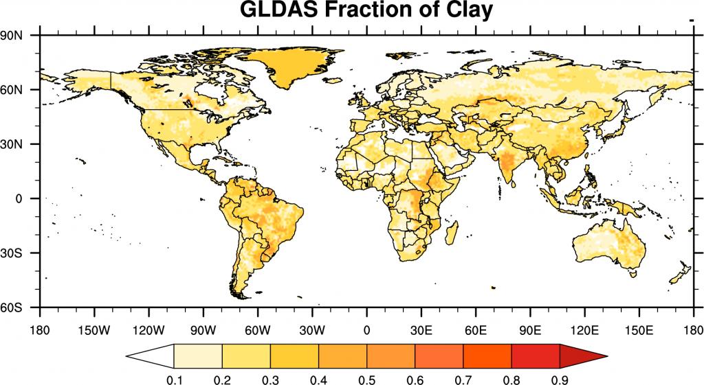
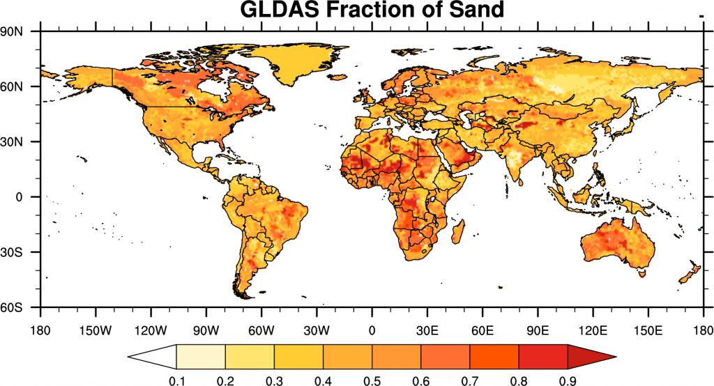
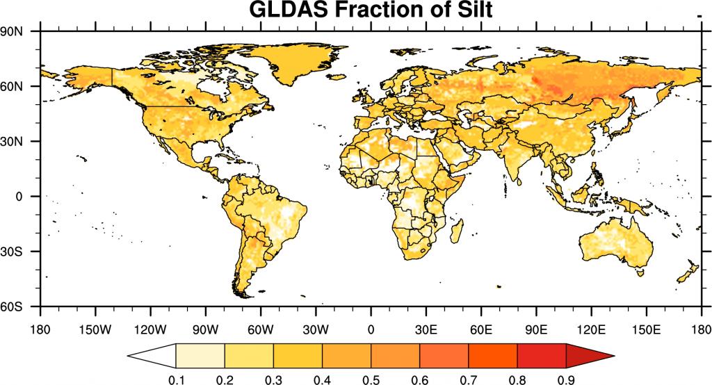
Soil fraction maps used in GLDAS2
- GLDAS Fractions of clay, sand, and silt Data (NetCDF): 0.25 degree, 1 degree
- GLDAS Fractions of caly, sand, and silt Data in other format (zip file including big_endian Binary data, Fortran code to read in, and GrADS control files): 0.25 degree, 1 degree
GLDAS Soil Porosity
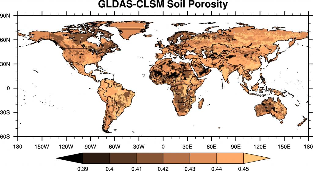
Soil Porosity used in GLDAS2/Catchment LSM
- Porosity for CLSM Data (NetCDF): 0.25 degree, 1 degree