FLDAS Vegetation Class
The land cover input data used in FLDAS Noah and Noah-MP land surface model simulations are based on the IGBP-modified Moderate Resolution Imaging Spectroradiometer (MODIS) dataset. The University of Maryland land cover dataset is used in the FLDAS-Forecast Catchment land surface model (CLSM) simulations.
The grid-dominant land cover classification data files (NetCDF format) based on the IGBP-modified MODIS can be downloaded from: FLDAS-Global (also illustrated below) ; FLDAS-Central Asia ; FLDAS-Forecast .
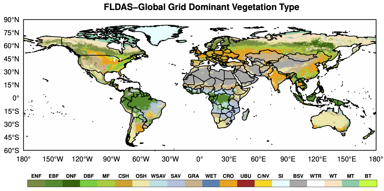
| Index | Legend | Definition |
| 1 | ENF | Evergreen Needleleaf Forest |
| 2 | EBF | Evergreen Broadleaf Forest |
| 3 | DNF | Deciduous Needleleaf Forest |
| 4 | DBF | Deciduous Broadleaf Forest |
| 5 | MF | Mixed Forests |
| 6 | CSH | Closed Shrublands |
| 7 | OSH | Open Shrublands |
| 8 | WSAV | Woody Savannas |
| 9 | SAV | Savannas |
| 10 | GRA | Grasslands |
| 11 | WET | Permanent Wetlands |
| 12 | CRO | Croplands |
| 13 | UBU | Urban and Built-Up |
| 14 | C/NV | Cropland/Natural Vegetation Mosaic |
| 15 | SI | Snow and Ice |
| 16 | BSV | Barren or Sparsely Vegetated |
| 17 | WTR | Water bodies |
| 18 | WT | Wooded Tundra |
| 19 | MT | Mixed Tundra |
| 20 | BT | Barren Tundra |
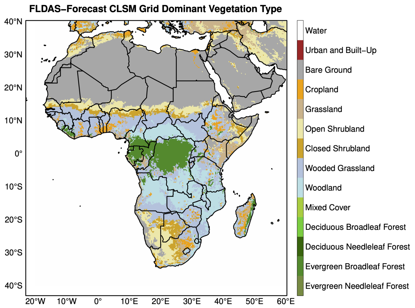
The dominant University of Maryland land cover classifications on FLDAS-Forecast-CLSM grid are illustrated below, and can be downloaded from HERE .