

GLDAS Vegetation Class/Mask
GLDAS currently uses the land surface datasets from the Moderate Resolution Imaging Spectroradiometer (MODIS) as our "standard". Some land surface models are however, tied to the Advanced Very High Resolution Radiometer (AVHRR) based datasets for the vegetation parameters. The GLDAS version 2 products (GLDAS2) use the data described on this page.
GLDAS Land/Sea Mask Dataset
GLDAS adopted the MOD44W MODIS Water Mask as the standard land/sea mask. The mask data [Carroll et al, 2009] is produced at University of Maryland and described here. Instead of deriving the mask from a land cover data as done in GLDAS1, the standard mask is "imposed" to land cover data and other surface parameter maps in GLDAS2. In order to create the land/sea masks on this page, the percent coverage of 0.01 degree water pixels in each GLDAS grid box was used such that grid boxes made up of more than 50% water were assigned a "water" value of 0 in the GLDAS land/sea mask, while all other grid boxes received a "land" value of 1.
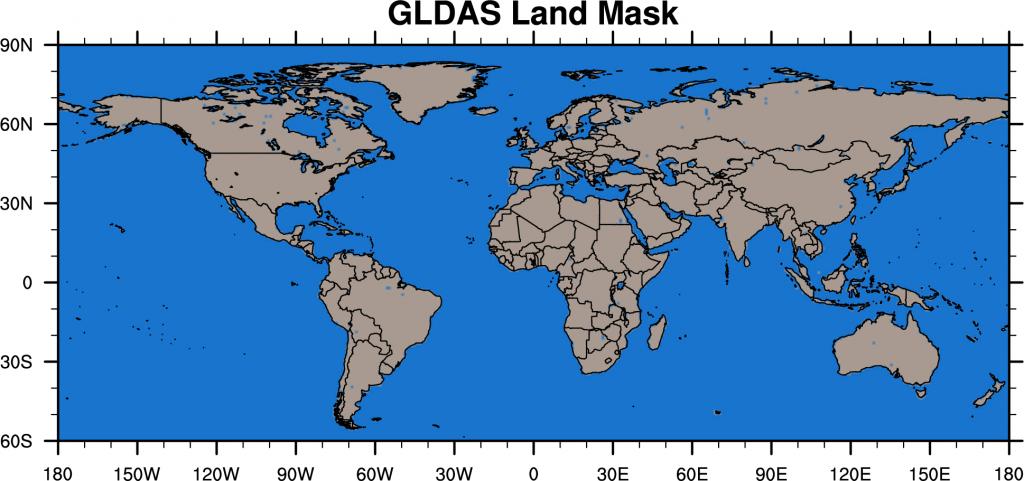
GLDAS standard Land/Sea Mask
- GLDAS standard Land/Sea Mask Data (NetCDF): 0.25 degree, 1 degree
GLDAS Land Cover Dataset
GLDAS runs its one dimensional land surface models on vegetation-based tiles to simulate variability below the scale of the model grid squares. A tile is not tied to a specific location within the grid square. Instead, each tile represents the area covered by a given vegetation type. A high resolution land cover dataset at 1 km resolution is the basis for designating tile space. In GLDAS2, different land cover classification schemes are used depending on the land surface model.
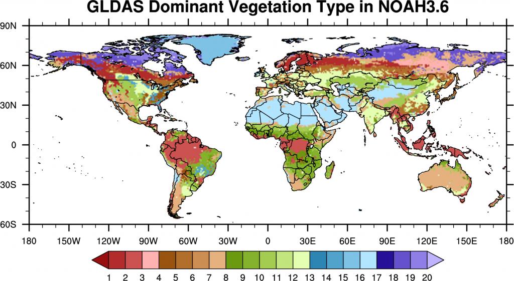
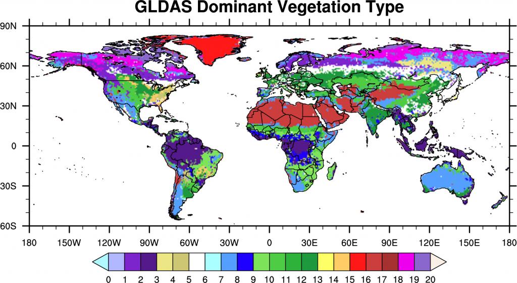
The land cover in GLDAS2/Noah is based on a 30 arc second MODIS vegetation data that uses modified IGBP classification scheme (see details). The predominant vegetation type in each 0.25 degree grid square is shown below.
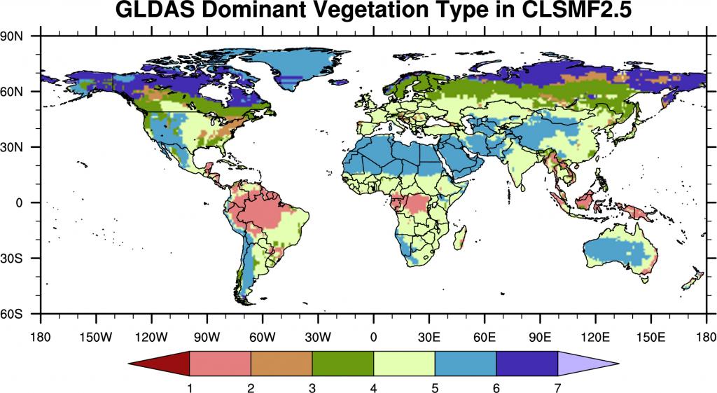
The land cover in GLDAS2/Catchment is based on a 30 arc second USGS Global Land Cover Characteristics Data data that is mapped onto the Mosaic classification scheme. The catchment model uses hydrologic catchment tiles and each tile has the primary and secondary vegetation types. The predominant vegetation type in each 1 degree grid square is shown below.
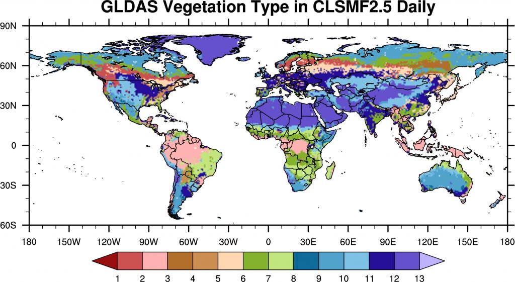
In the 0.25 degree, Daily Catchment simulations (GLDAS-2.0 and GLDAS-2.2), vegetation tiling is not applied and the UMD land cover classification scheme [Hansen et al., 2000] is used. The vegetation type in each 0.25 degree grid square is shown below.
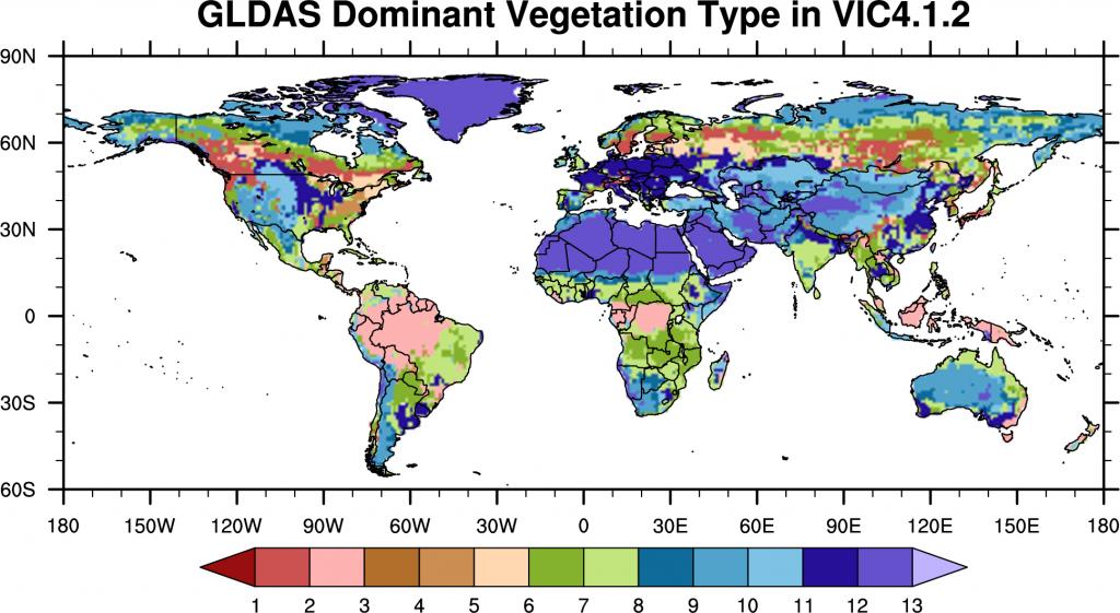
The land cover in GLDAS2/VIC is also based on a 1 km AVHRR land cover data of UMD classification scheme [Hansen et al., 2000]. The predominant vegetation type in each 1 degree grid square is shown below.
Vegetation Types for the Land cover schemes in the GLDAS2 products (key for above figures)
| Model | Noah | Catchment | VIC, Catchment (daily) |
|---|---|---|---|
| Index |
Modified MODIS IGBP Vegetation Type |
Mosaic Vegetation Type | UMD Vegetation Type |
| 0 | missing value | missing value | missing value |
| 1 | Evergreen Needleleaf Forest | Broadleaf Evergreen Trees | Evergreen Needleleaf Forest |
| 2 | Evergreen Broadleaf Forest | Broadleaf Deciduous Trees | Evergreen Broadleaf Forest |
| 3 | Deciduous Needleleaf Forest | Needleleaf Trees | Deciduous Needleleaf Forest |
| 4 | Deciduous Broadleaf Forest | Grassland | Deciduous Broadleaf Forest |
| 5 | Mixed Forest | Broadleaf Shrubs, Bare Soil, Desert Soil | Mixed Cover |
| 6 | Closed Shrublands | Dwarf Trees | Woodland |
| 7 | Open Shrublands | Wooded Grasslands | |
| 8 | Woody Savannas | Closed Shrublands | |
| 9 | Savannas | Open Shrublands | |
| 10 | Grassland | Grasslands | |
| 11 | Permanent Wetland | Cropland | |
| 12 | Cropland | Barren | |
| 13 | Urban and Built-Up | Urban and Built-Up | |
| 14 | Cropland/Natural Vegetation Mosaic | ||
| 15 | Snow and Ice | ||
| 16 | Barren or Sparsely Vegetated | ||
| 17 | Ocean | ||
| 18 | Wooded Tundra | ||
| 19 | Mixed Tundra | ||
| 20 | Bare Ground Tundra |
- GLDAS2/Noah Dominant Vegetation Type Data (NetCDF): 0.25 degree, 1 degree
- GLDAS2.0 & GLDAS2.1/Catchment Dominant Vegetation Type Data (NetCDF): 1 degree
- GLDAS2.0 & GLDAS2.2/Catchment Dominant Vegetation Type Data (NetCDF): 0.25 degree
- GLDAS2/VIC Dominant Vegetation Type Data (NetCDF): 1 degree