NCA-LDAS Concept/Goals
The National Climate Assessment - Land Data Assimilation System (NCA-LDAS) is one of NASA's contributions to the National Climate Assessment of the United States. The NCA-LDAS is led by scientists at NASA Goddard Space Flight Center's Hydrological Sciences Laboratory.
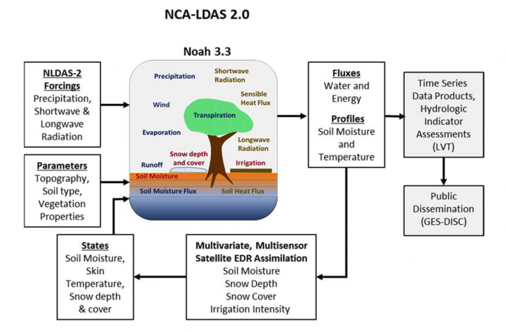
The objectives of NCA-LDAS are first, to consolidate and deliver the water analysis capabilities of the Land Information System (LIS) software to support an Integrated Terrestrial Water Analysis; and second, to develop and evaluate selected water indicators for terrestrial storages and fluxes including soil moisture, snow, evapotranspiration, and discharge using NCA-LDAS output, in situ data, and NASA's extensive archive of satellite derived products. Prototype indicators for the United States for the period 1979 to present will be compared to long-term global indicators, to understand how national trends relate to global trends.
NCA-LDAS consists of the following four sub-tasks:
(1) Synthesis and analysis of water availability Environmental Data Records (EDRs) from 1979-present for a CONUS-centered section of North America.
(2) Assimilation of multiple water availability EDRs into the Land Information System for this same region from 1979-present to develop an NCA-LDAS.
(3) Evaluation of the NCA-LDAS results, including water budget statistics, trends and synthesis; and
(4) Development of water availability indicators from land surface water storage and flux databases, including snow, soil moisture, evapotranspiration, streamflow, and surface temperature.