FLDAS: Project Goals
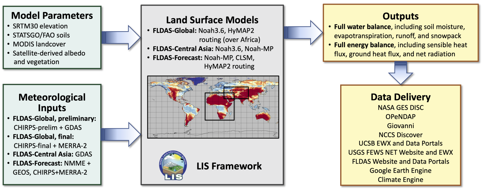
FLDAS is the Famine Early Warning Systems Network (FEWS NET) Land Data Assimilation System. The goal of FLDAS is to use observational datasets and advanced modeling and data assimilation methods to generate high quality fields of land surface states and fluxes used for FEWS NET decision support. The FLDAS systems are custom instances of the NASA Land Information System (LIS) that have been adapted to work with the domains, data streams, and monitoring and forecast requirements associated with food security assessment in data-sparse, developing countries.
FLDAS consists of three modeling systems, FLDAS-Global, FLDAS-Central Asia, and FLDAS-Forecast, that are run routinely over several domains. FLDAS-Global (McNally et al. 2017) is run twice a month (a preliminary run and a final run) and produces monthly outputs at 0.1° spatial resolution over a quasi-global domain. FLDAS-Central Asia (McNally et al. 2022) is run in near real-time (with ~1-day latency) over the Central Asia domain and produces output at 0.01° spatial resolution. FLDAS-Forecast (Arsenault et al. 2020; Hazra et al. 2023) is run over Africa and the Middle East and produces monthly forecasts at 0.25° spatial resolution out to 5 months.