

GLDAS Vegetation Specification
GLDAS Leaf Area Index and Canopy Greenness
This page describes some vegetation specfications used in GLDAS, specifically Leaf Area Index (LAI) and Canopy greenness fraction (fg). GLDAS has the capability to use both climatology and near real-time satellite derived products of LAI and fg. Currently, GLDAS uses monthly climatology of LAI and fg datasets.
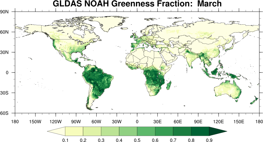
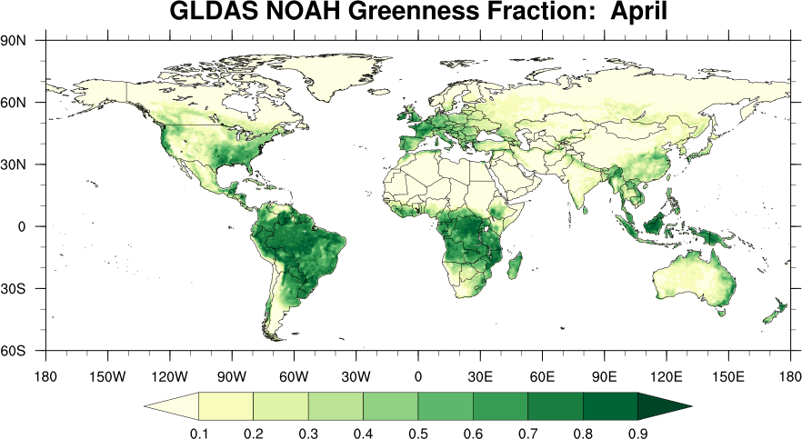
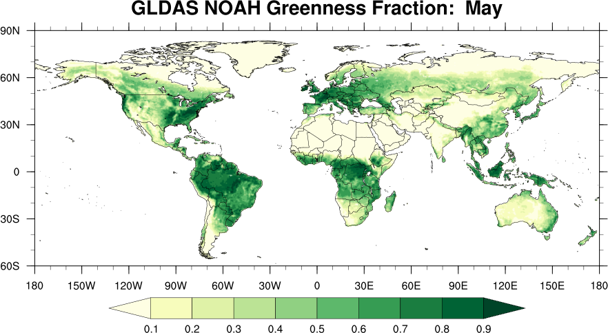
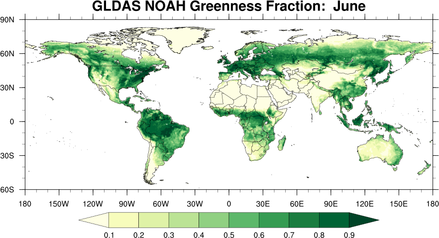
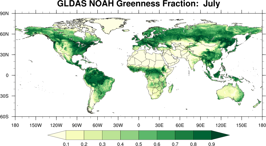
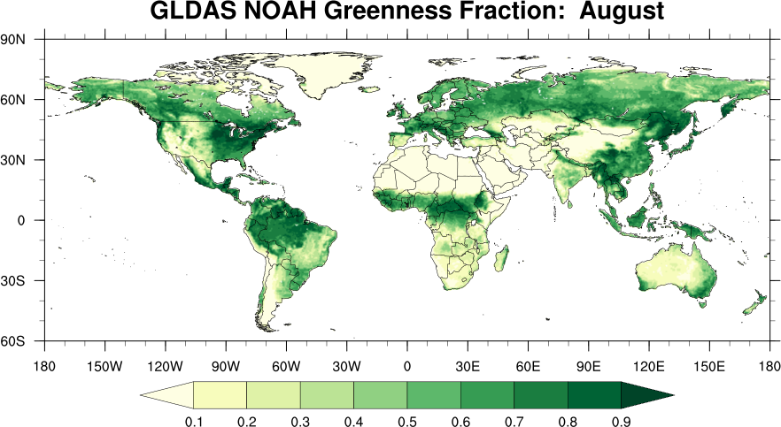
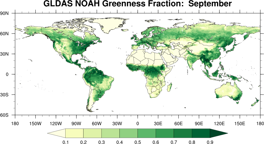
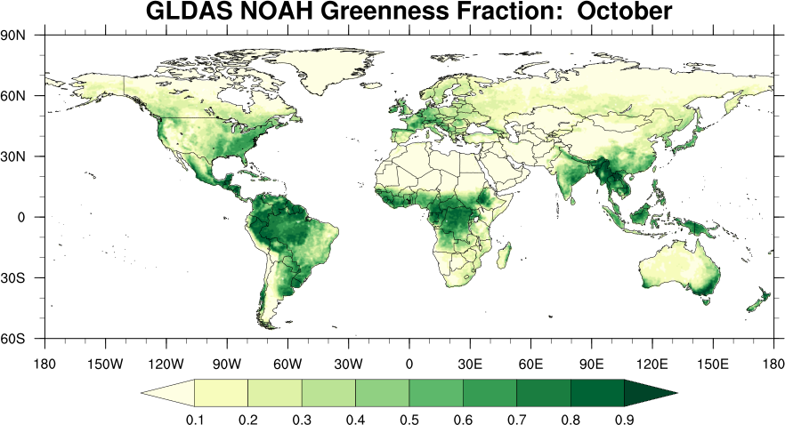
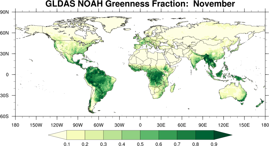
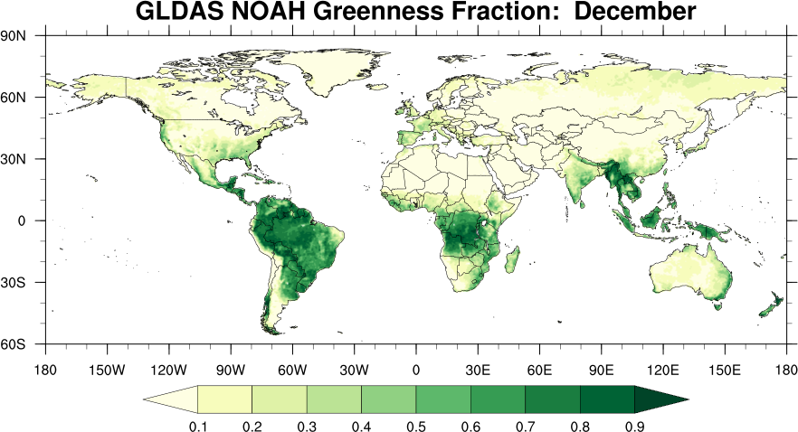
The figures below are monthly data. The LAI data are based on AVHRR satellite, 20-year climatology from 1982 - 2001. The greenness fraction data are the Noah LSM default dataset from NCEP, based on AVHRR satellite, 5-year climatology from 1985-1989.
| Month of Year | Leaf Area Index | Greenness Fraction |
|---|---|---|
| January | 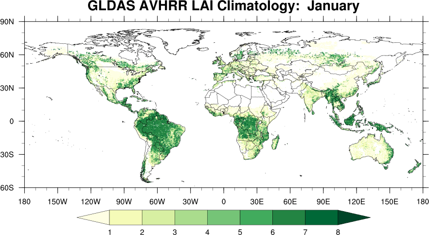 |
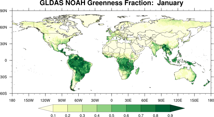 |
| February | 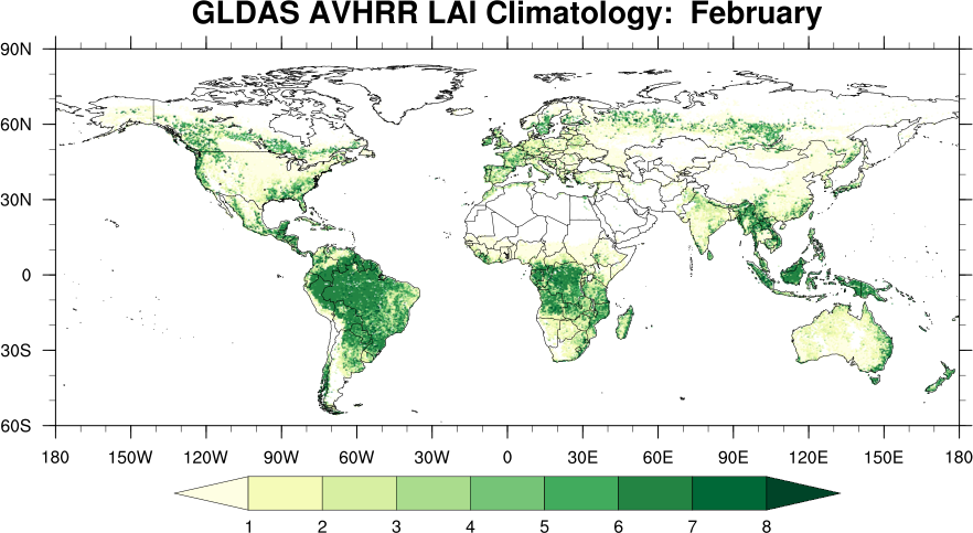 |
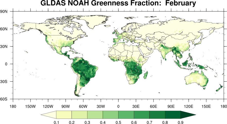 |
| March | 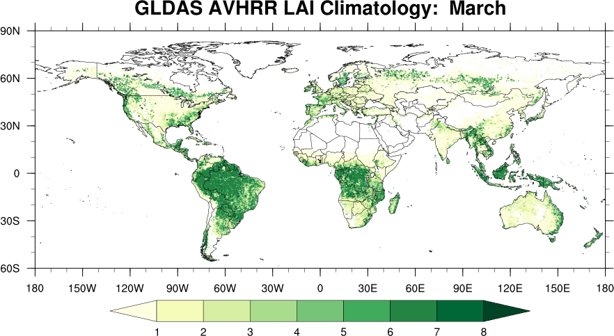 |
 |
| April | 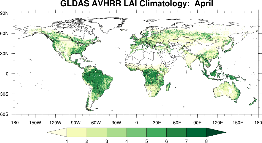 |
 |
| May | 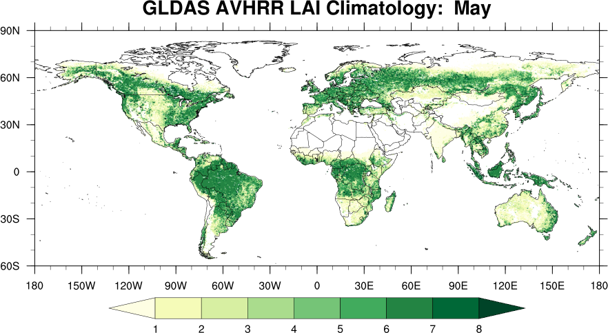 |
 |
| June | 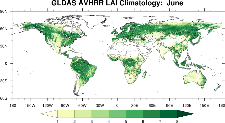 |
 |
| July | 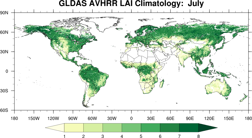 |
 |
| August | 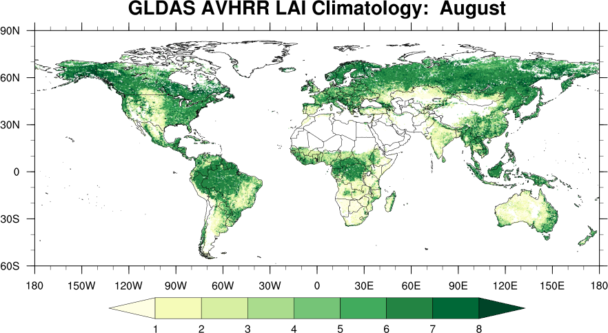 |
 |
| September | 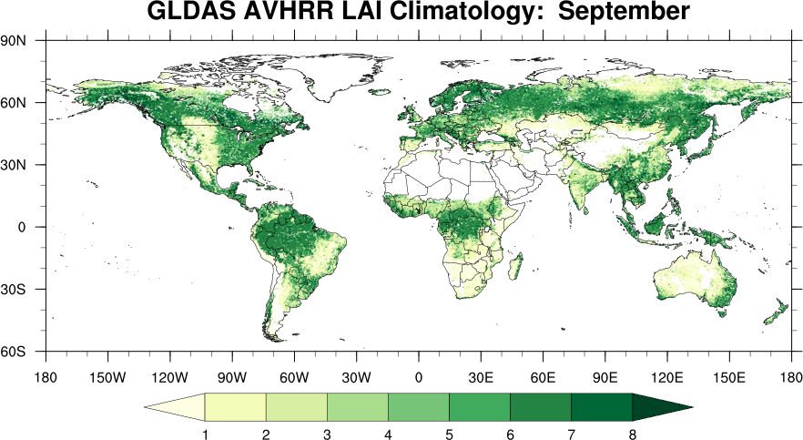 |
 |
| October | 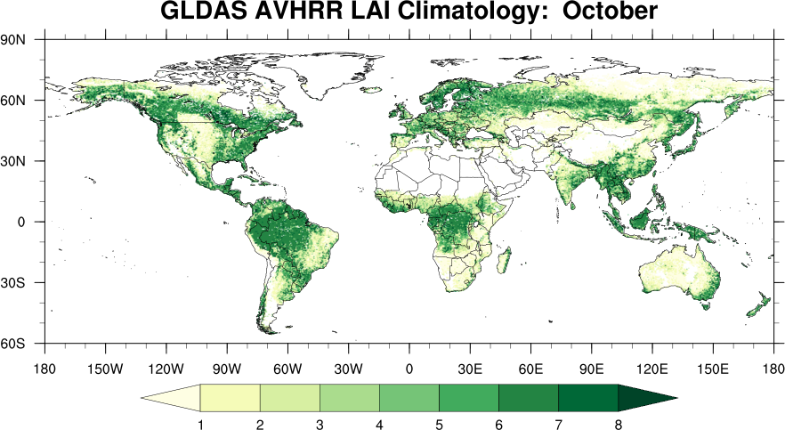 |
 |
| November | 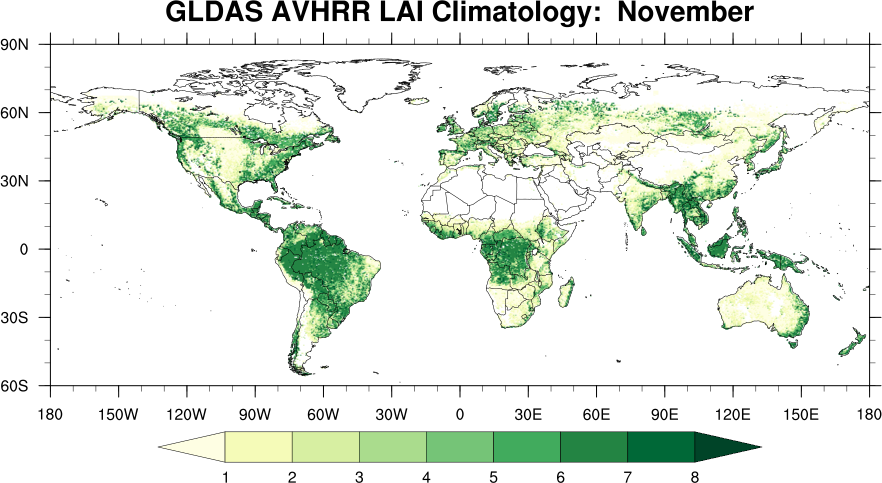 |
 |
| December | 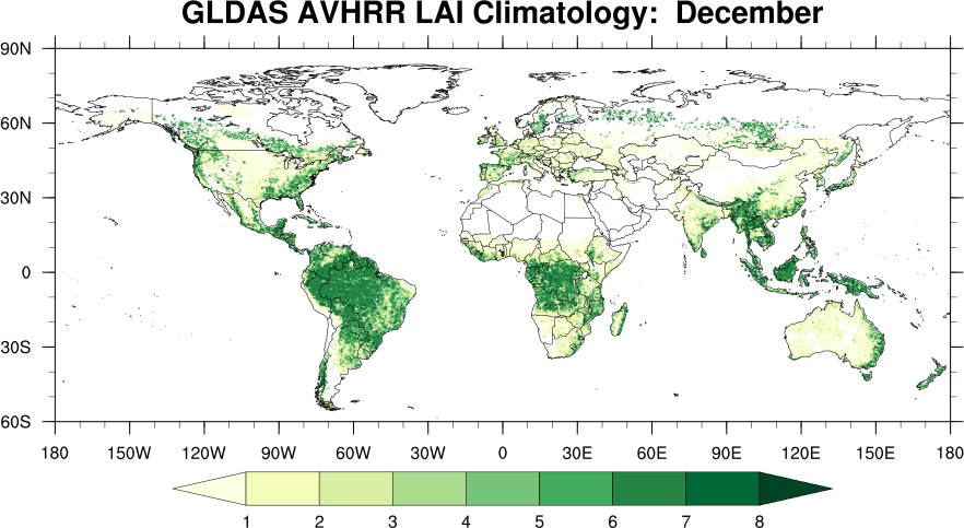 |
 |
- GLDAS Noah Greenness Fraction Monthly Data (NetCDF): 0.25 degree, 1 degree
- GLDAS Catchment-F2.5 Greenness Fraction Monthly Data (NetCDF): 0.25 degree, 1 degree
- GLDAS Catchment-F2.5 LAI Monthly Data (NetCDF): 0.25 degree, 1 degree