

NCA-LDAS Specifications
The NCA-LDAS domain covers the contiguous United States, as well as portions of Canada and Mexico, extending from 25 to 53 North, and -125 to -67 West. The spatial resolution of the simulations and datasets is 1/8th-degree over this domain. The domain and grid is the same as the NLDAS domain.
The NCA-LDAS grid is defined as follows:
*Table below scrolls to right
| Position | Grid Column | Grid Row | Longitude | Latitude |
|---|---|---|---|---|
| Lower Left | 1 | 1 | -124.9375 | 25.0625 |
| Lower Right | 464 | 1 | -67.0625 | 25.0625 |
| Upper Right | 464 | 224 | -67.0625 | 52.9375 |
| Upper Left | 1 | 224 | -124.9375 | 52.9375 |
(latitude/longitude values represent center of 1/8th-degree grid boxes)
This NCA-LDAS file contains various masks as depicted below:
- NCA-LDAS masks (netCDF-4 format)
- README file (describes the masks)
The following figure shows the CONUS (contiguous United States) mask for the NCA-LDAS domain:

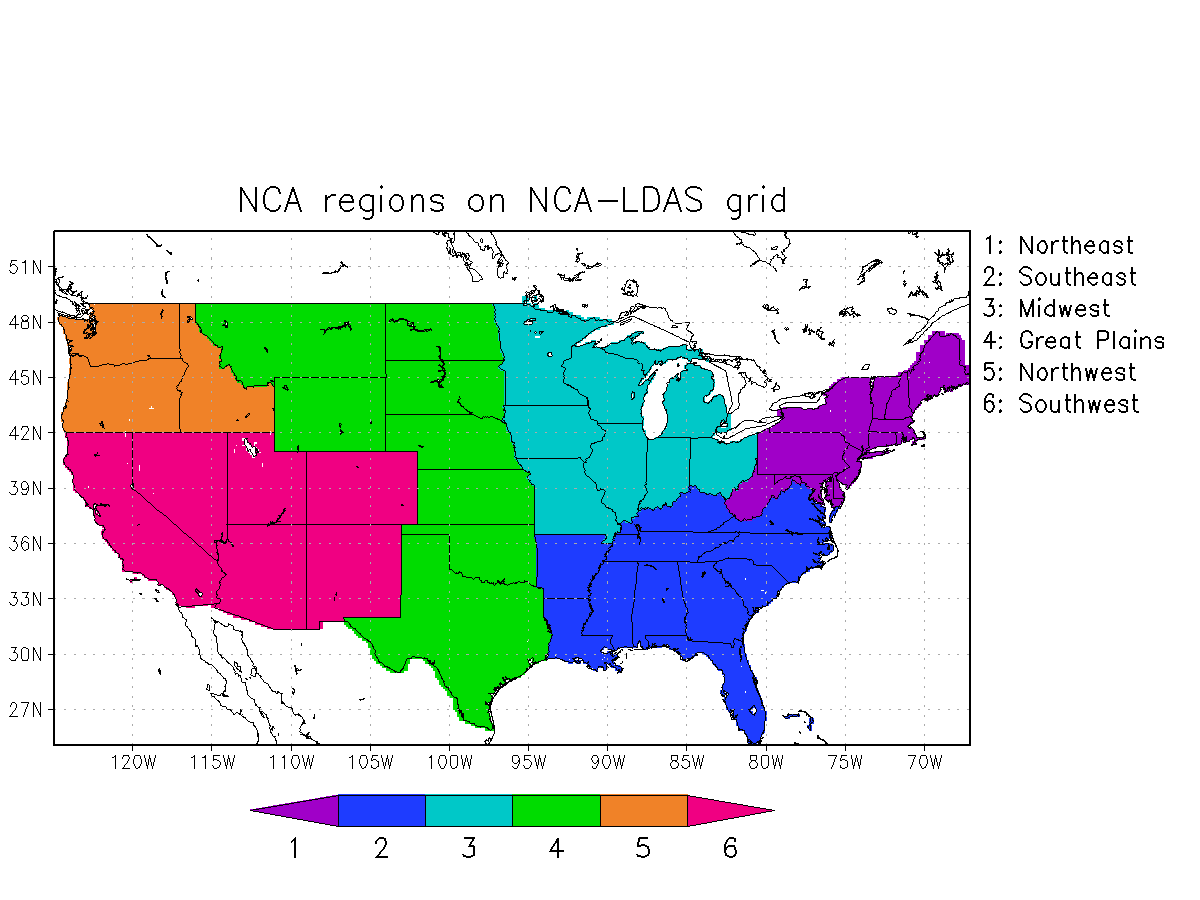
The following figure shows the mask for the six (6) NCA regions for the NCA-LDAS domain. Note that a separate mask is also available that splits the Great Plains region into northern (MT, ND, SD, WY, NE) and southern (KS, OK, TX) regions:
The following figure shows the mask for the U.S. Drought Monitor (USDM) regions for the NCA-LDAS domain. According to the USDM definitions, WY and CO are included in both the West and in the High Plains regions:

The following figure shows the mask for the USGS HUC02 river basins for the NCA-LDAS domain:

The following figure shows the mask for the Columbia river basin as well as for the Upper Colorado river basin for the NCA-LDAS domain:

The following figure shows the mask for the regions of the National Weather Service's River Forecast Centers:

The following figure shows the mask for the Sturm snow classes:
