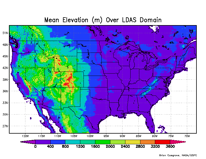
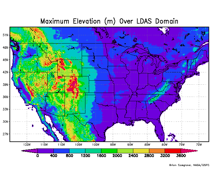
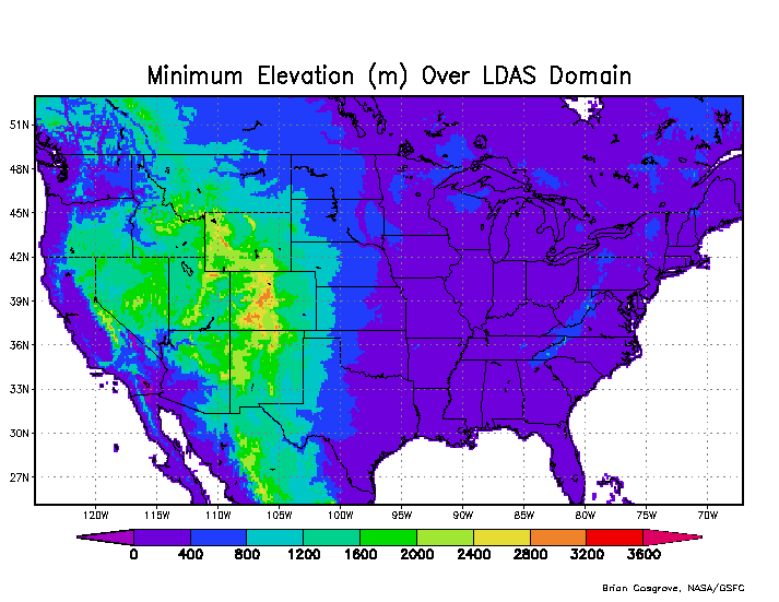
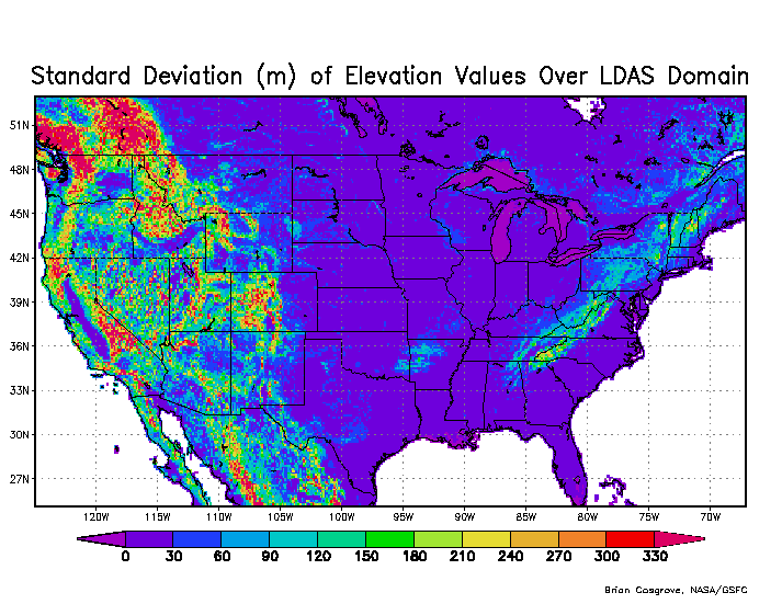
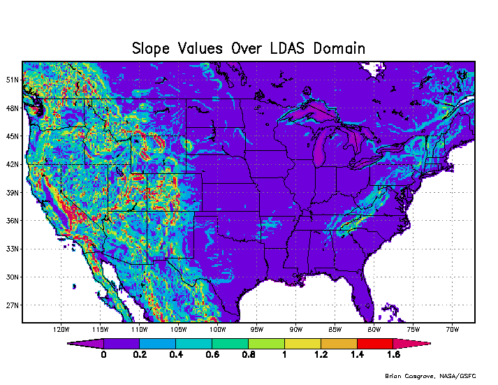
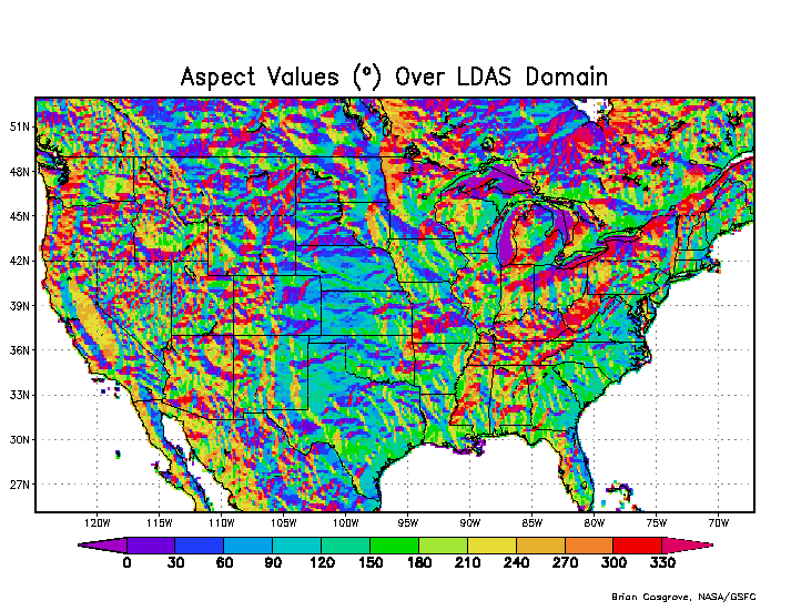
NLDAS Elevation Datasets and Illustrations
The 1/8th-degree resolution topographic datasets and illustrations featured below are based on the GTOPO30 Global 30 Arc Second (~1-km) Elevation Dataset. In particular, average elevation values over the NLDAS domain were arrived at by isolating the relevant subset of data from the ~1-km global dataset, and then averaging up to the 1/8th-degree NLDAS resolution. Slope and aspect values were then derived from this 1/8th-degree data. Maximum, minimum, and standard deviation values, by contrast, were calculated directly from the ~1-km values which lie within each 1/8th-degree NLDAS grid box.
NLDAS Topographical Datasets
- NLDAS elevation data (netCDF-4 format)
NLDAS Topographical Illustrations